Old Ordnance Survey Maps of Aberdeen
These are the maps we publish for the City of Aberdeen. Each map includes an introduction.
They are available through our On-line Mapshop
Aberdeen became a County of a City in 1900, and so was independent of Aberdeenshire. It was absorbed by Grampian Region in 1975 but in
1996 it became a unitary council.
For other maps of Aberdeenshire go to the Aberdeenshire page.
See This Page for more information on the area's local government history.

These are the maps we publish in Aberdeen:
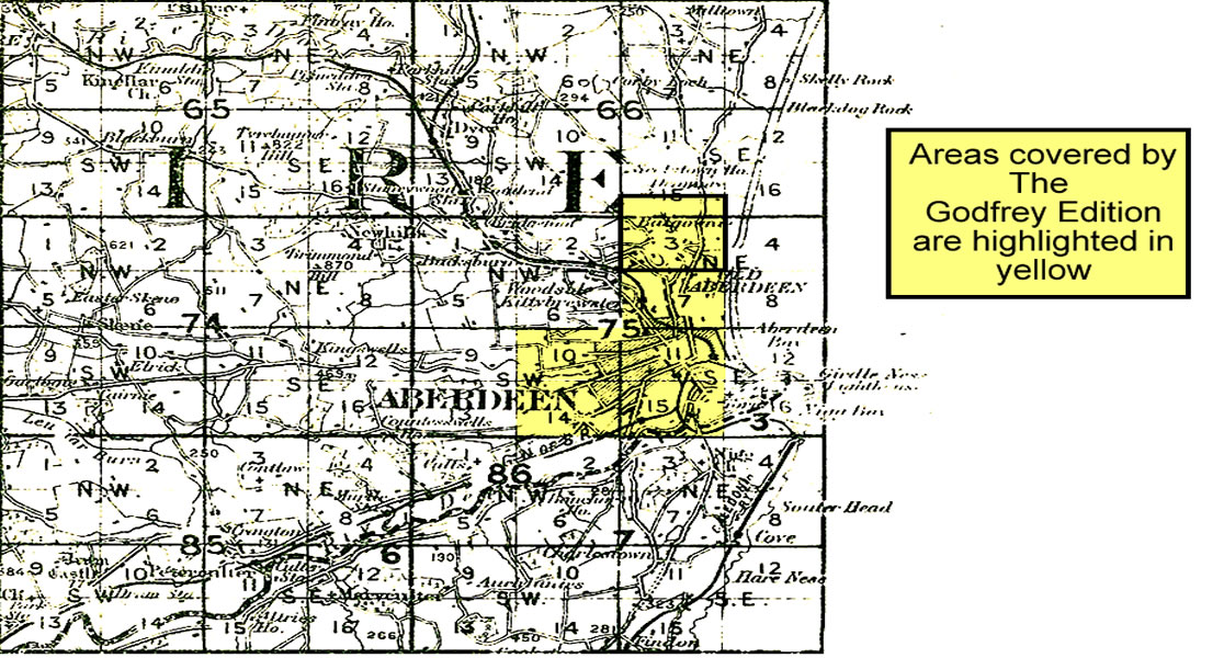
You might find this Index Map useful.
For maps of Aberdeenshire (incl Banff and Kincardineshire) go to the Aberdeenshire page.
 Most maps in the Godfrey Edition are taken from the 25 inch to the mile map and reduced to about 15 inches to the mile.
For a full list of maps for Scotland, return to the Scotland page
You can order maps direct from our On-line Mapshop.
This list shows all our maps for the county. We try to keep a full range in print but inevitably some titles fall out of print from time to time.
These are noted in our On-line Mapshop.
Most maps in the Godfrey Edition are taken from the 25 inch to the mile map and reduced to about 15 inches to the mile.
For a full list of maps for Scotland, return to the Scotland page
You can order maps direct from our On-line Mapshop.
This list shows all our maps for the county. We try to keep a full range in print but inevitably some titles fall out of print from time to time.
These are noted in our On-line Mapshop.
Alan Godfrey Maps, Prospect Business Park, Leadgate, Consett, DH8 7PW. Tel 01207 583388
The Godfrey Edition / sales@alangodfreymaps.co.uk / 6 November 2016