Old Ordnance Survey Maps of Ayrshire

  • These detailed maps normally cover an area of about one and a half miles by one mile. Each map includes an introduction.
  • They are available through our On-line Mapshop

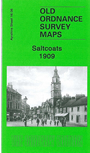
  • Here are the details of maps for Saltcoats:

  • Ayrshire Sheet 16.06 Saltcoats 1909 - published 2008; intro by Gilbert Bell. ISBN.978-1-84784-169-8

    This detailed map covers the Ayrshire coastal town of Saltcoats. Most of the town centre is covered, and coverage stretches eastward to Auchenharvie Colliery (Pits 1,2,4,5 and 6) and to the western edge of Stevenston. Features include railways with both Saltcoats stations, North church, Outer Harbour, Melbourne Park, Magnesia House, Daylight Mine, Auchenharvie, Auchenharvie Cottages, Town Hall, Dockhead Street etc. and the town centre shown in detail with individual buildings neatly delineated.

    The map links up with Ayrshire sheet 16.05 Ardrossan South to the west.


  • Follow this link for a complete list of our Ayrshire maps.
  • You can order maps direct from our On-line Mapshop. For other information and prices, and other areas, go to The Index Page.
  • Maps in the Godfrey Edition are taken from the 25 inch to the mile map and reduced to about 15 inches to the mile. For a full list of maps for Scotland, return to the Scotland page.
    The Godfrey Edition / sales@alangodfreymaps.co.uk / 15 November 2016