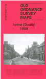
Ayrshire Sheet 17.13 Irvine (South) 1908 - published 2009; intro by Gilbert Bell. ISBN.978-1-84784-218-3 
This detailed map covers the southern half of Irvine, with coverage stretching from Bridgegate southward. Features include GSWR railway works way department, station, part of
Irvine Harbour Branch, Fullarton, River Irvine, Warrix Fireclay Works, Warrix Coal Pit, Townhead, church and cemetery, Montgomery Street, etc.
Follow this link for a complete list of our Ayrshire maps.
You can order maps direct from our On-line Mapshop.
For other information and prices, and other areas, go to The Index Page.
Maps in the Godfrey Edition are taken from the 25 inch to the mile map and reduced to about 15 inches to the mile.
For a full list of maps for Scotland, return to the Scotland page.
The Godfrey Edition / sales@alangodfreymaps.co.uk / 15 November 2016

 Here are the details of maps for Irvine (South):