We have published more than 2,400 maps in our series of Old Ordnance Survey Map reprints; this includes more than 150 in Scotland, with a growing range of maps around Glasgow and the area to the SW. The maps are highly detailed. They are taken from the OS 1:2,500 (or 25 inch) maps and reduced to about 15 inches to the mile. Each covers an area of a mile and a half by a mile. They show streets with individual houses, tram tracks, railway tracks and even signals, factories, wharves and such details as fountains and water troughs. They will provide hours of fascination for historians and genealogists. The maps are neatly folded and each includes a specially written introduction to the area. Maps can be purchased on our On-line Mapshop where further information about titles is given. Or visit The Index Page for a full list to the series and details of Prices.
Here are the details of maps for Prestwick:
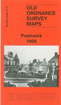
This detailed map of Prestwick is double sided for maximum coverage, and includes both sheets 27.10 and 27.14. Sheet 27.14 covers the southern half of Prestwick, with coverage stretching from Waterloo Road northward to Burgh Road and Gardiner Street. Features include Kingcase, St Nicholas Golf Links, Bellrock Cottage, tramway, Biggart Memorial Home, church and manse, etc. On the reverse is sheet 27.10, extending coverage northward to include station, Prestwick Golf Club, St Nicholas church (in ruins), Monkton Junction, St Cuthbert's Gold Club, Carlaverock etc.
The map links up with Ayrshire sheet 33.02 Newton on Ayr to the south.
Follow this link for a complete list of our Ayrshire maps.
You can order maps direct from our On-line Mapshop. For other information and prices, and other areas, go to The Index Page.
Maps in the Godfrey Edition are taken from the 25 inch to the mile map and reduced to about 15 inches to the mile. For a full list of maps for Scotland, return to the Scotland page.
The Godfrey Edition / godfreyedition@btinternet.com / 7 December 2010