
Old Ordnance Survey Maps of Barnet
We have very good coverage for the London Borough of Barnet, which was formed in 1965 from the Municipal Boroughs of Finchley and Hendon, and the Urban
Districts of Friern Barnet (in Middlesex) and Barnet and East Barnet (in Hertfordshire).
The area includes maps from both our London and Middlesex series, which link up with each other.
The following titles are all taken from the OS 25" maps and reduced to a scale of approximately 14 inches to the mile. All maps
are available from our On-line Mapshop.
 These are the detailed maps for Barnet in our London series:
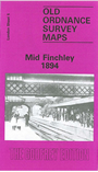
5a Mid Finchley 1894 - published 1985; intro by Pamela Taylor
5b Mid Finchley 1911 - published 2015; intro by Pamela Taylor
5c Mid Finchley 1934 - published 2016; intro by Pamela Taylor
6a Alexandra Park & South Friern 1894 - published 1989; intro by Pamela Taylor
6b Alexandra Park & South Friern 1911 - published 2014; intro by Pamela Taylor
6c Alexandra Park & South Friern 1935 - published 2015; intro by Alan Godfrey
10a East Finchley 1894 - published 1985; intro by Pamela Taylor
10b East Finchley & Hampstead Garden Suburb 1894-1911 - published 1997; intro by Pamela Taylor
10c East Finchley & Hampstead Garden Suburb 1939 - published 2016; intro by Pamela Taylor
17a Golders Green 1894 - published 1988; intro by Joanna Corden
17b Golders Green & Brent Cross 1894-1912 - published 1997; intro by Pamela Taylor
17c Golders Green 1936 - published 2023; intro by Pamela Taylor
18 Kenwood & Golders Hill 1894 - published 1991; intro by Pamela Taylor
 These are the detailed maps for Barnet in our Middlesex series:
06.03 Barnet & Hadley 1896 -published 1987; intro by Jane Downey
06.04 Monken Hadley 1896 - published 1991; intro by Stewart Gillies
06.05 Elstree 1895 - published 2009; intro by Pamela Taylor
06.07 Barnet Common 1895 - published 1991; intro by Pamela Taylor
06.08 New Barnet 1896 - published 1985; intro by Pamela Taylor
06.10 Highwood Hill 1895 - published 1995; intro by Jill Barber
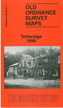
06.11 Totteridge 1895 - published 1988; intro by John Heathfield & Percy Reboul
06.12 Whetstone 1897 - published 1987; intro by Percy Reboul & John Heathfield
06.13a Edgware 1895 - published 1987; intro by Pamela Taylor
06.13b Edgware 1935 - published 2009; intro by Pamela Taylor
06.14 Mill Hill Broadway 1895 - published 1994; intro by Pamela Taylor
06.15 Mill Hill Village 1898 - published 1989; intro by Graham Roberts
06.16a North Finchley 1894 - published 1986; intro by Pamela Taylor
06.16b North Finchley 1911 - published 1997; intro by Pamela Taylor
07.09 East Barnet & Southgate 1897 - published 1992; intro by Gillian Gear & Pamela Taylor
07.13 Friern Barnet & New Southgate 1898 - published 1987; intro by Pamela Taylor
11.01 Burnt Oak & Little Stanmore 1895 - published 1998; intro by Pamela Taylor
11.02 Burnt Oak & Hendon Aerodrome 1935 - published 1993; intro by Stewart Gillies
11.03 Finchley & Holders Hill 1895 - published 1988; intro by Pamela Taylor
11.06 Kingsbury Green & The Hyde 1895-1911 - published 1995; intro by Jill Barber
11.07a Hendon 1895 - published 1995; intro by Pamela Taylor
11.07b Hendon 1912 - published 1996; intro by Pamela Taylor
11.07c Hendon 1936 - published 2023; intro by Pamela Taylor
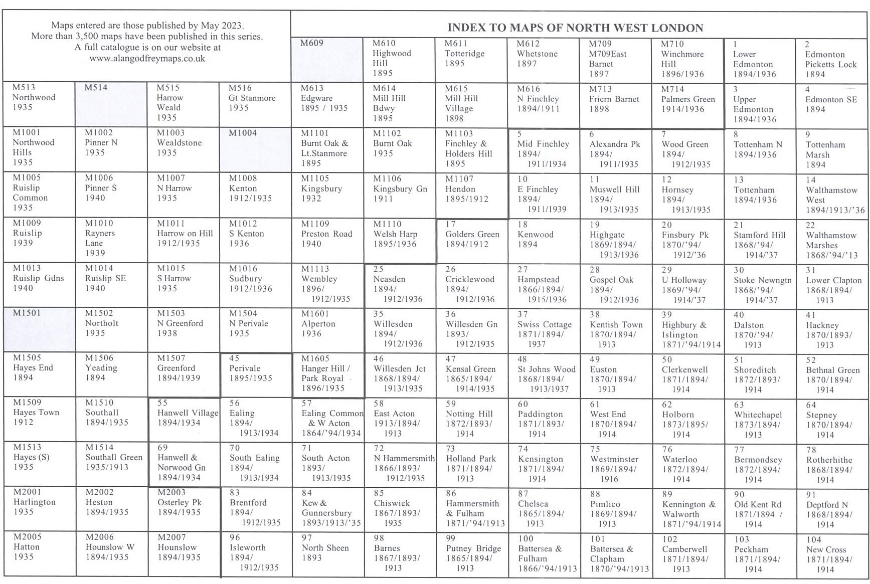
Here is an index grid of maps in the Barnet and North West London area
 Most maps in the Godfrey Edition are taken from the 25 inch to the mile map and reduced to about 15 inches to the mile.
For a full list of English maps, return to the England page
You can order maps direct from our On-line Mapshop.
Most maps in the Godfrey Edition are taken from the 25 inch to the mile map and reduced to about 15 inches to the mile.
For a full list of English maps, return to the England page
You can order maps direct from our On-line Mapshop.
Alan Godfrey Maps, Prospect Business Park, Leadgate, Consett, DH8 7PW. Tel 01207 583388
The Godfrey Edition / sales@alangodfreymaps.co.uk / 20 April 2023