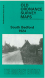
Bedfordshire Sheet 16.04 South Bedford 1924 - published 1992. ISBN.978-0-85054-530-2 
This detailed map of South Bedford includes County Hospital, Chocolate Works, Railway Station, St Mary & Helena's Church, St Leonards Church and Bricklayers Arms Public House. Some of the streets on the map include London Road, Elstow Road, Ampthill Road, Kempston Road and Brittania Road. On the revese of the map we include a street directory for the area.
Follow this link for a complete list of our Bedfordshire maps.
You can order maps direct from our On-line Mapshop.
For other information and prices, and other areas, go to The Index Page.
Most maps in the Godfrey Edition are taken from the 25 inch to the mile map and reduced to about 15 inches to the mile.
For a full list of maps for England, return to the England page.
The Godfrey Edition / sales@alangodfreymaps.co.uk / 22 January 2018

 Here are the details of maps for South Bedford: