Old Ordnance Survey Maps of Bexleyheath


We have published more than 2,400 maps in our series of Old Ordnance Survey Map reprints, some 500 of them in the London area. The maps are highly detailed. They are taken from the OS 1:2,500 (or 25 inch) maps and reduced to about 15 inches to the mile. They show streets with individual houses, tram tracks, railway tracks and even signals, factories, wharves and such details as fountains and water troughs. They will provide hours of fascination for historians and genealogists. The maps are neatly folded and each includes a specially written introduction to the area. Maps can be purchased on our On-line Mapshop where further information about titles is given. Or visit The Index Page for a full list to the series and details of Prices.


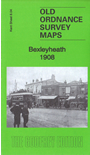
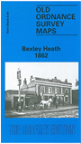
Here are the details of maps for Bexleyheath:

  • Kent Sheet 8.04 Bexley Heath 1862 - published 1994; introduction by Malcolm Barr-Hamilton

    This early and highly detailed OS map covers what was still called Bexley Heath; the name did not become Bexleyheath until later in the century. Coverage extends from Crook Log and Upton Lane eastward to Gravel Hill and a little beyond, the principal feature of the map being the many houses in leafy gardens spread along the Dover Road, which goes west-east across the map. Features include Mill Road with a corn windmill, Warren Farm, church, Essex Place, Markall Lane, and several pubs on the main road. Beyond this it remains a rural scene. A directory of Bexley Heath is on the reverse.

    An index map showing the areas covered by this and adjacent Kent maps is available here. The map links up with Kent Sheets 2.16 Bexleyheath North to the north, 9.01 Crayford to the east, 8.08 Bexley to the south.


    Follow this link for a complete list of our London Series maps or this for a list of the Kent Series maps.

    You can order maps direct from our On-line Mapshop. For other information and prices, go to The Index Page.


    Maps in the Godfrey Edition are taken from the 25 inch to the mile map and reduced to about 15 inches to the mile. For a full list of maps for London, return to the London page

    The Godfrey Edition / godfreyedition@btinternet.com / 10 Jan 2011