
 Here are the details of maps for Bridgnorth:

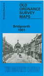
This detailed map of the historic town of Bridgnorth is double-sided to give maximum coverage. The main map covers the southern half of the town, with coverage stretching from St Mary's Street southward to Oldbury and Danesford. Features include Listley Street, Castle Hill, the station, Oldbury Terrace, Little Brug, Upper Town, Lower Town, the Hydraulic Lift (or Cliff Railway), malthouse, tannery, Bridge Street, St Mary Magdalene's church; further south is Oldbury, with St Nicholas church and Oldbury House, Panpudding Hill. On the back is a large portion of adjacent sheet 58.08 extending coverage northward, and this includes St Leonard's church, Friars Mill, Tippings Cross Coppice, cemetery, Smithfield, workhouse, infirmary, Cantern Brook Bridge.