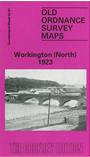
 Here are the details of maps for Workington (North):

This detailed map of north Workington is double-sided for maximum coverage.
The main map covers the northern part of the town from St Michael's church northward to Oldside Iron & Steel Works. Features include River Derwent, Lonsdale Park football ground, The Green, Church Street, LMSR railway with Derwent Junction, Lonsdale Dock, Lowther Iron Works (disused), Oldside Iron & Steel Works, Lonsdale Dock Branch, Cleator & Workington line with Calva Junction, engine shed, Cockermouth & Workington line with Workington Bridge station, North Side, New Bridge Road, Old Dock, Workington Bridge, Lonsdale Dock Branch etc.
On the reverse we include adjacent sheet 53.06 extending coverage westward to include shipbuilding yard, mouth of the River Derwent, John Pier, breakwaters. Extracts from a 1925 directory are also included.
The map links up with Cumberland sheet 53.11 Workington South to the south.