Old Ordnance Survey Maps of Clackmannanshire
We have published a range of maps for Clackmannanshire. Each includes an introduction.
They are available through our On-line Mapshop
Clackmannanshire was one of the first counties to be included in the Godfrey Edition. Please note that the maps listed below are currently out of print. We would, of course,
be interested in reprinting them if there is sufficient demand..
See This Page for more information on the area's local government history.
 These are the maps we publish for Clackmannanshire:
- Sheet 133.12 Alva, Menstrie & Tullibody 1899 - published 1985, introduction by Jean Peacock
- Sheet 134.07 Dollar 1899 - published 1984, intro by Jean Peacock
- Sheet 134.09 Tillicoultry 1899 - published 1984, intro by Jean Peacock
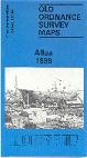
- Sheet 139.04 Alloa 1899 - published 1983, intro by Jean Peacock
- Sheet 140.05 Clackmannan & Kincardine 1898 - published 1984, intro by Jean Peacock
These maps are currently out of print.
A little about the towns: Alva is a planned mill town which was developed from the late 18th century; with numerous mills
it had grown to a population of some 5,000 by the time of our map, and even had its own railway branch, of which the terminus is shown here; the map just reaches the Devon colliery. On the
reverse are smaller maps for the villages of Menstrie and Tullibody, the first with mills, the second with
a large tannery.
Dollar is effectively two towns, the old town, beneath the glen and castle, and, further down the Dollar Burn, the
new town, developed after the Dollar Institution or Academy had been opened in 1819. The town grew further after the arrival of the Devon
Valley railway. On the reverse is a smaller map, for the Perthshire village of Muckart.
Alloa is our main map in the county, and is double-sided, showing as much of the town as
possible. The main map covers the heart of the town with its railway station and several industrial tramways; Carsebridge Distillery; and stretching to Inglewood and Keilarsbrae. The backing map covers Alloa Harbour with its
shipyards and other industry, along with the ferry across to South Alloa.
Clackmannan was a King's Seat from the time of David I, the nearby forests providing ideal hunting. However, it gradually
declined in importance, in 1822 finally losing its Sherriff court to Alloa. The map shows it as a tiny town, but railway historians will find two
stations here, plus a long tramway to Craigrie quarry. On the reverse is a map of the Fifeshire town of Kincardine, with its ropery, shipping pier, and little railway terminus.
Most maps in the Godfrey Edition are taken from the 25 inch to the mile map and reduced to about 15 inches to the mile.
They cost just £ 3.00 each. For a full list of Scottish maps, return to the Scotland page
You can order maps direct from our On-line Mapshop.
Alan Godfrey Maps, Prospect Business Park, Leadgate, Consett, DH8 7PW. Tel 01207 583388
The Godfrey Edition / sales@alangodfreymaps.co.uk / 14 March 2016