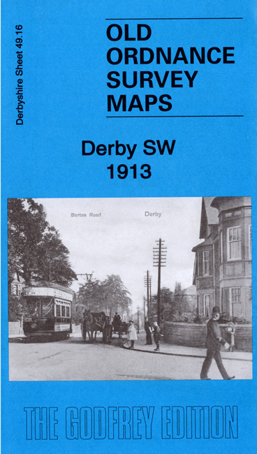
Derbyshire 49.16 Derby SW 1913 - published 2020; intro by Barrie Trinder. ISBN.978-1-78721-299-2 
This detailed map covers the SW part of Derby, with coverage stretching from Bakewell Street and Stonehill Road westward.
Features include California, Rowditch, Abbey Ward, Derby Borough Lunatic Asylum, Derby Union Workhouse, Old Cemetery, tramways, Uttoxeter Road and Uttoxeter New Road,
Burton Road, St Luke's church, Diocesan Training College for Schoolmistresses, etc
The map links up with Derbyshire sheet 49.12 Derby NW to the north and 50.13 Derby South to the east.
Follow this link for a list of our maps for Derby and here for the rest of Derbyshire.
You can order maps direct from our On-line Mapshop.
For other information and prices, and other areas, go to The Index Page.
Maps in the Godfrey Edition are taken from the 25 inch to the mile map and reduced to about 15 inches to the mile.
For a full list of maps for England, return to the England page.
Alan Godfrey Maps, Prospect Business Park, Leadgate, Consett, Co Durham, DH8 7PW / sales@alangodfreymaps.co.uk / 20 January 2020
 Here are the details of maps for Derby (SW):