 Here are the details of maps for Talwrn:

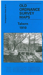
This detailed map covers the Talwrn area, SW of Wrexham. Coverage stretches from Offa's Dike westward to Bronwlfa Wood. Features include the GWR Rhos Branch, Legacy station and a short stretch of the Legacy Branch, Talwrn, Bryn-yr-Owen, Pentre-bychan Hall, Cadwgan Hall, Bronwylfa, Vrondeg Hall, Aber-oer. Directories of Esclusham Below and Above, plus a railway timetable for the Wrexham to Ponkey Crossing Halt and Wrexham to Wynn Hall Halt lines are included on the reverse.
The map links up with sheets 35.02 Rhosllanerchrugog to the south.