 Here are the details of maps for Chopwell:

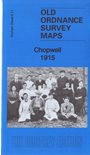
This very detailed map covering the village of Chopwell is double-sided for maximum coverage.
The main map covers the village of Chopwell, extending eastward into Chopwell Wood. Features include St John's church, Garesfield & Chopwell Railway, Chopwell Colliery Pit No.1, coke ovens, Chopwell Hotel, RC church, Chopwell Mill etc. Chopwell, sometimes known as 'Little Moscow', is one of the best known of Durham's pit villages.
On the reverse we include a section of adjacent sheet 5.10 showing No.2 and No.3 Pits, wagonway, old coal pits etc. (Chopwell directory details are included on the reverse of the Blackhall Mill map.)
The map links up with Sheet 5.15 Blackhall Mill to the south.
Maps in the Godfrey Edition are taken from the 25 inch to the mile map and reduced to about 15 inches to the mile. For a full list of maps for England, return to the England page.
Alan Godfrey Maps, Prospect Business Park, Leadgate, Consett, Co Durham, DH8 7PW / sales@alangodfreymaps.co.uk / 8 December 2018