Old Ordnance Survey Maps of Gorgie


We have published more than 2,400 maps in our series of Old Ordnance Survey Map reprints; this includes more than 150 in Scotland, with a good range of maps around Edinburgh. The maps are highly detailed. They are taken from the OS 1:2,500 (or 25 inch) maps and reduced to about 15 inches to the mile. Each covers an area of a mile and a half by a mile. They show streets with individual houses, tram tracks, railway tracks and even signals, factories, wharves and such details as fountains and water troughs. They will provide hours of fascination for historians and genealogists. The maps are neatly folded and each includes a specially written introduction to the area. Maps can be purchased on our On-line Mapshop where further information about titles is given. Or visit The Index Page for a full list to the series and details of Prices.


Here are the details of maps for Gorgie:

  • Edinburghshire Sheet 3.10 Gorgie 1905 - published 1994; introduction by Andrew Bethune

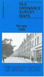
    This detailed map covers the Gorgie area, on the west side of Edinburgh, with coverage stretching from North Merchiston Cemetery westward to Saughton Public Park, and from Roseburn southward to Gorgie Farm.

    Features on the map include Caledonian Railway Wester Dalry and Haymarket branches, North British Railway with Corstorphine Branch and Suburban Line, with Gorgie and Pinkhill stations, engine sheds, tramways, Saughton Hall, Gorgie area, Gorgie Mills, St Andrew Biscuit Works, Edinburgh Brewery, Wester Dalry, North British Distillery, Balgreen, Saughtonhall Mains, Edinburgh Foundry, Murrayfield Mills etc. On the reverse we include a section of the 1893 version of the map, showing the Wester Dalry area at an earlier stage.

    The map links up with Edinburgh Sheets 3.06 Murrayfield to the north, Corstorphine to the west, 3.11 Merchiston to the east and 3.14 Slateford to the south.


    You might find this index map useful.


    Follow this link for a complete list of our Edinburgh maps.

    You can order maps direct from our On-line Mapshop. For other information and prices, and other areas, go to The Index Page.


    Maps in the Godfrey Edition are taken from the 25 inch to the mile map and reduced to about 15 inches to the mile. For a full list of maps for Scotland, return to the Scotland page.

    The Godfrey Edition / godfreyedition@btinternet.com / 9 Dec 2010