We have published more than 2,400 maps in our series of Old Ordnance Survey Map reprints; this includes more than 150 in Scotland, with a good range of maps around Edinburgh. The maps are highly detailed. They are taken from the OS 1:2,500 (or 25 inch) maps and reduced to about 15 inches to the mile. Each covers an area of a mile and a half by a mile. They show streets with individual houses, tram tracks, railway tracks and even signals, factories, wharves and such details as fountains and water troughs. They will provide hours of fascination for historians and genealogists. The maps are neatly folded and each includes a specially written introduction to the area. Maps can be purchased on our On-line Mapshop where further information about titles is given. Or visit The Index Page for a full list to the series and details of Prices.
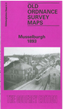
Here are the details of maps for Musselburgh:
This detailed map of Musselburgh is double-sided for maximum coverage.
The main map covers the southern part of the town, with coverage from the High Street southward to Monktonhall House, and from Stoneyhill House eastward to Pinkiehill. Features include River Esk, Inveresk Mills, Musselburgh Wire Mill, NBR branch with Musselburgh terminus, Inveresk Combination Poorhouse, small stretch of main line with Inveresk station, Pinkieburn, Pinkie House, Market Street, High Street (on both sides of Esk), Esk Net Mills, Fisherrow area, Town Hall etc.
On the reverse we include adjacent sheet 4.07, covering the area to the north, including the waterfront. Features here include Fisherrow Harbour, New Street, Fisherrow Links, part of Musselburgh Links and race course, Loretto School, Jubilee Bridge, Gravelbank House etc.
The map partly links up with Edinburgh Sheet 4.06 Portobello East to the west.
You might find this index map useful.
Follow this link for a complete list of our Edinburgh maps.
You can order maps direct from our On-line Mapshop.
For other information and prices, and other areas, go to The Index Page.
Maps in the Godfrey Edition are taken from the 25 inch to the mile map and reduced to about 15 inches to the mile.
For a full list of maps for Scotland, return to the Scotland page.