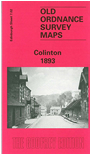
Edinburghshire Sheet 7.02 Colinton 1893 - published 1999; intro by Colinton Local History Society. ISBN.978-1-84151-055-2 
This detailed map covers the village of Colinton, SW of Edinburgh.
Features include Balerno Branch with Colinton station, Colinton village, Colinton Farm, West Mills, Redford, Redford Bridge, Colinton House, Bonally, Katesmill, Colinton Barley Mill, ruined castle, etc. On the reverse we include a section of the 1905 revision of the map, showing the village at a later date.
The map links up with Edinburgh Sheet 3.14 Slateford to the north.
Follow this link for a complete list of our Edinburgh maps.
You can order maps direct from our On-line Mapshop.
For other information and prices, and other areas, go to The Index Page.
Maps in the Godfrey Edition are taken from the 25 inch to the mile map and reduced to about 15 inches to the mile.
For a full list of maps for Scotland, return to the Scotland page.
The Godfrey Edition / sales@alangodfreymaps.co.uk / 29 October 2016
 Here are the details of maps for Colinton: