 Here are the details of maps for Edinburgh (South Bridge):

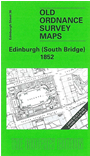
This very detailed map covers the area around and to the east of South Bridge, with coverage stretching from Hunter Square eastward to The Queen's Drive, and from Canongate southward to Richmond Street.
Features include College, Royal Infirmary, Surgeons Hall, Medical School, Normal School, all shown in great detail; also Nicholson Square, High Street (east), Salisbury Craigs, Pleasance etc. On the reverse we include a selection of street directory entries, nincl Adam Street, College Street, Cowgate, Drummond Street, High Street, Pleasance.
The map links up sheet 30 Edinburgh Calton Hill to the north and 35 Edinburgh Castle to the west.