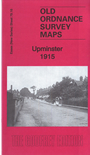
Essex (New Series) 79.16 Upminster 1915 - published 2016; intro by Alan Godfrey. ISBN.978-1-78721-025-7 
This detailed map covers the centre of Upminster plus the eastern part of Hornchurch.
Features include railway with Upminster station and stretch of Romford Branch; engine depot, St Laurence's church, Hoppey Hall, Hill Place, 'The Old Chapel', Upminster windmill, New Place, chapels
etc. On the Hornchurch side the map includes St Andrew's church, brewery, Hacton Hill Farm, disused windmill, etc. We also include the list of residents from a 1922 directory.
The map links up with Essex Sheet 79.15 Hornchurch to the west.
Follow this link for a list of our maps for Essex in outer London or here for Havering.
You can order maps direct from our On-line Mapshop.
For other information and prices, and other areas, go to The Index Page.
Maps in the Godfrey Edition are taken from the 25 inch to the mile map and reduced to about 15 inches to the mile.
For a full list of maps for England, return to the England page.
Alan Godfrey Maps, Prospect Business Park, Leadgate, Consett, Co Durham, DH8 7PW / sales@alangodfreymaps.co.uk / 25 November 2017

 Here are the details of maps for Upminster: