Old Ordnance Survey Maps of Flintshire

  • These detailed maps normally cover an area of about one and a half miles by one mile. Each map includes an introduction.
  • They are available through our On-line Mapshop

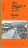
  • Here are the details of maps for Prestatyn:

  • Flintshire Sheet 1.12 Prestatyn 1910 - published 2010; intro by Derrick Pratt. ISBN.978-1-84784-364-7

    This detailed map is double-sided for maximum coverage. The main map covers most of the town centre, with coverage running from the High Street westward to Towyn-Isaf, southward to Pen-r'hwylfa. Features include railway with station, section of Prestatyn & Cwm Branch, Christ Church, Victoria Road, Warrington Summer Camp.

    On the reverse we include a good section of adjacent sheet 2.09 extending coverage eastward to Gronant Road, Pendre Avenue, Linden Walk, Nant Mill, Homefield, and southward to Limestone Quarries.


  • Follow this link for a complete list of our Flintshire maps.
  • You can order maps direct from our On-line Mapshop. For other information and prices, and other areas, go to The Index Page.
  • Maps in the Godfrey Edition are taken from the 25 inch to the mile map and reduced to about 15 inches to the mile. For a full list of maps for Wales, return to the Wales page.
    The Godfrey Edition / sales@alangodfreymaps.co.uk / 6 January 2018