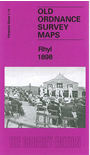
 Here are the details of maps for Rhyl:

This detailed map is double-sided for maximum coverage. The main map covers most of the town, from Rhyl Bridge eastward to the Grand Pavilion. Features include railway with station, Rhyl Bridge, Foryd Hall, Palace Theatre, St John's church, Wellington Terrace, town centre with individual buildings neatly shown, Town Hall, Grand Pavilion, Holy Trinity church, St Thomas church, engine shed, Morfa Hall, Claremont Hydropathic, Bryn-tirion Farm, Ty'n Rhyl, Bethel Chapel, Morfa-bach, St Ann's church, Yacht Farm, Cefndy Road etc.
On the reverse we include adjacent sheet 1.10 extending coverage northward to include Rhyl Promenade Pier, Bijou Pavilion, Morannedd, Marine Hydropathic.