Old Ordnance Survey Maps of Dundee (S)


We have published more than 2,400 maps in our series of Old Ordnance Survey Map reprints, including a small group in Forfarshire. The maps are highly detailed. They are taken from the OS 1:2,500 (or 25 inch) maps and reduced to about 15 inches to the mile. Each covers an area of a mile and a half by a mile. They show streets with individual houses, tram tracks, railway tracks and even signals, factories, wharves and such details as fountains and water troughs. They will provide hours of fascination for historians and genealogists. The maps are neatly folded and each includes a specially written introduction to the area. Maps can be purchased on our On-line Mapshop where further information about titles is given. Or visit The Index Page for a full list to the series and details of Prices.


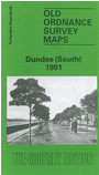
  • Here are the details of maps for Dundee (South):

  • Forfarshire Sheet 54.09 Dundee (South) 1901 - published 1990; introduction by Linda McGill

    This detailed map covers the southern part of Dundee, with coverage stretching from West Magdalen Green eastward to King William IV Dock, and from Guthrie Street southward to the Esplanade.

    Features include CR and NBR railways with Tay Bridge station, West station, engine sheds, mineral and goods depots, Esplanade station, north end of Tay Bridge, Magdalen Green station, Ashton Works, Seafield Works, Tayfield Works, Magdalen Green, West Poorhouse, Larchfield Works, tramways, University College, Belmont Works, Steeple church, East church, Seabraes Mill, Craig Harbour and Pier, Tidal Harbour, Earl Grey Dock, King William IV Dock, Green Market etc. On the reverse we include street directory entries for Annfield Road/Row/Street, Magdalen Green,Nethergate, Step Row, Thomson Street.

    The map links up with Forfarshire sheet 54.05 Dundee West to the north.


    Follow this link for a complete list of our Forfarshire maps.

    You can order maps direct from our On-line Mapshop. For other information and prices, and other areas, go to The Index Page.


    Maps in the Godfrey Edition are taken from the 25 inch to the mile map and reduced to about 15 inches to the mile. For a full list of maps for Wales, return to the Wales page.

    The Godfrey Edition / godfreyedition@btinternet.com / 12 Dec 2010