
 Here are the details of maps for Aberdare:

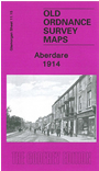
This detailed map covers the central area of Aberdare, with coverage extending from Nevile Terrace and Oxford Street southward to Dumfries Park, and from Llwynhelig Colliery eastward to Sunnybank Street and Gwar Street.
Features on a busy map include the town centre in detail with individual buildings neatly shown; Taff Vale Railway with station, GWR Vale of Neath line with station, sidings and goods sheds, Taff Vale Railway's Dare Valley Branch, GWR Cwmaman Branch, Aberdare & Hirwaun Tramway, street tramways, St Elvan's church, Foundry Town area, Gadlys area, St John the Baptist church, Blaengwawr Level, Graig Rhiw Mynach, Llwynhelig Colliery with tramway, Glanare House, remains of old tramways and mine workings, etc. On the reverse we include a 1906 Aberdare directory, entries Gr-Ol.
The map links up with Glamorgan sheets 11.11 Aberdare North to the north and 11.16 Aberdare East to the east.