
 Here are the details of maps for Pontypridd (S):

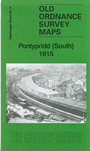
This detailed map covers the southern half of Pontypirdd, with coverage stretching from the station southward to Coed Dan-y-ty and Coed Gelli-draws, and from Coed Graig-fach eastward to Tower Street.
Features include southern part of town centre, Maritime Colliery, Workhouse, Pontypridd Junction, station, Taff Vale Railway, Barry Railway with station and tunnel, Woodroad Quarry, Infirmary, Isolation Hospital, Court House, tramways, Coke Works, Pen-y-rhiw Colliery, mineral railways and tramways, quarries etc. On the reverse we include a list of private residents from a 1906 directory.
The map links up with Glamorgan sheets 28.15 Treforest to the east.