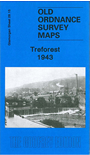
 Here are the details of maps for Treforest:

This detailed map covers Treforest, at the eastern edge of Pontypridd, including Glyn-Taf (sometimes spelt Glyn-Taff or Glyntaff), and part of Rhyd-y-Felin. Coverage stretches from King Street eastward to Coed Craig-lwyd and Pant-drain.
Features include River Taff, Castle Bridge, School of Mines, GWR Cardiff & Merthyr line with station, Caerphilly & Pontypridd line with several halts, Glamorganshire Canal, Glyn-Taf Cemetery, Taff Vale Park, Pentre-Bach, Junior Technical School, schools, chapels, Lewistown Park, St Dyfrig's RC church, St Mary's church, Dynea Colliery (disused), Glyn-Taf, old mineral tramway route, Treforest Junction, Electrical Works, etc.
On the reverse we include a 1906 directory of Treforest plus a 1929 railway timetable for the Newport-Pontypridd line.
The map links up with Glamorgan sheets 28.14 Pontypridd South to the west