
 Here are the details of maps for Bristol NW:


We have published two versions of this map, showing how the area changed across the years. The 1882 version is fully coloured, taken from the beautiful handcoloured Ordnance Survey 1st edition map.
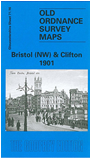
The maps cover a major area of Bristol, together with much of Clifton. Coverage stretches from Clifton College eastward to Stokes Croft, and from Brandon Hill and Bristol Bridge northward to Apsley Road and Chantry Road. The many features include Tyndall's Park, Park Row, tramways, Victoria Rooms, Victoria Park, St Andrew's church, Christ Church, Zoo, Clifton College, Clifton Down station, Cotham, Haymarket, St James church, Colston Avenue, St Nicholas church, tram depot, Royal Infirmary, Colston Hall, Cabot Tower, Turkish Baths, University College, St George's church, Grammar School, Guildhall, Kingsdown, St Augustine's Bridge, etc. On the reverse we include street extracts from contemporary street directories.
The map links up with sheets 71.12 Redland to the north, 71.15 Clifton Down to the west, 72.13 Bristol NE to the east and 75.04 Bristol SW to the south.
Maps in the Godfrey Edition are taken from the 25 inch to the mile map and reduced to about 15 inches to the mile. For a full list of maps for England, return to the England page.
Alan Godfrey Maps, Prospect Business Park, Leadgate, Consett, Co Durham, DH8 7PW / sales@alangodfreymaps.co.uk / 28 October 2016