Old Ordnance Survey One-Inch Maps


These maps are taken from the famous OS "Inch to the Mile" Maps. Though obviously far less detailed than the large scale maps for which we are perhaps better known, they provide an invaluable overview of a wider area, typically 18 miles across by 12 miles down. For transport historians they are invaluable for showing old railways, while all historians need them for their close depiction of topography, normally including parish boundaries. These maps also mean that we can offer historical coverage for small villages where a large scale map would not be commercially viable.

This group of Irish reprints was begun in the 1980s with some titles in Fermanagh and Tyrone. We now intend to publish the whole of Northern Ireland in this series, in addition to those for England and Wales. The maps include historical notes and most also include a large scale map of a small town or village in the area.

The maps are neatly folded and each includes a specially written introduction to the area. Maps can be purchased on our On-line Mapshop where further information about titles is given. Visit the Ireland page for a full list of Inch to the Mile Maps, or The Index Page for a full list to the series and details of Prices.

Here is information about Sheet 11:

  • Ireland Sheet 11 Lough Swilly & Derry/Londonderry 1900 - published 2001; introduction by Séamas Mac Annaidh

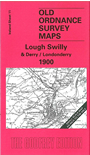
    This Inch to the Mile map covers the area around Lough Swilly. Most of the map is in Co Donegal, but a smaller area of Co Londonderry is in the SE corner. Coverage stretches from Rathmelton eastward to Muff, and from Buncrana southward to Derry City.

    The major feature is the city of Derry or Londonderry, but other features of interest include stretches of the Londonderry & Lough Swilly Railway, Buncrana Bay, Inch Island, the steam ferry from Fahan to Kerrs Bay, The Cul Bay, Eskaheen Mountain etc. On the reverse we includea map of Londonderry in 1788 from the Ordnance Survey Memoirs.


    It is not possible to list the many hamlets, farmsteads and other topographical features shown on these maps. However, you may find it useful if we list the towns and principal villages or church parishes that are included on this map. Links are given for those for which detailed large-scale maps are also available.

  • Co Donegal: Buncrana, Carrownamaddy, Fahan, Muff, Newtowncunningham. Rathmelton, Rathmullan.
  • Co Londonderry: Ballynagard, Derry/Londonderry.

    An index map is available showing the areas covered by the Inch to the Mile maps. Go to This Index Map.


    For a full list of maps for Ireland go to the Ireland page.

    You can order maps direct from our On-line Mapshop. For other information and prices, and other areas, go to The Index Page.


    Alan Godfrey Maps, Prospect Business Park, Leadgate, Consett, Co Durham, DH8 7PW / sales@alangodfreymaps.co.uk / 22 May 2009