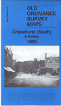
Kent Sheet 8.14 Chislehurst (South) & Bickley 1895 - published 2016; intro by Pamela Taylor. ISBN.978-1-84784-959-5 
This detailed map of Chislehurst and Bickley is double-sided for maximum coverage.
Features on the main map include Camden Park, Chislehurst station, Lower Camden, St John's church, Bickley Arms Hotel, Chislehurst Common, Holbrook Wood, St Nicholas church,
Shepherd Green, Scadbury Park, Perry Street (at eastern edge of map), Manor House, St Paul Cray's Common etc.
On the reverse is a portion of adjacent sheet 8.13, covering Bickley Hall.
For other maps in Bromley see our Bromley page.
Follow this link for a complete list of our London Series maps or this for a list of the Kent Series maps.
You can order maps direct from our On-line Mapshop.
For other information and prices, go to The Index Page.
Maps in the Godfrey Edition are taken from the 25 inch to the mile map and reduced to about 15 inches to the mile.
For a full list of maps for London, return to the London page
The Godfrey Edition / sales@alangodfreymaps.co.uk / 3 December 2016

 Here are the details of maps for Chislehurst: