We have published more than 2,400 maps in our series of Old Ordnance Survey Map reprints, including a group in Kent. The maps are highly detailed. They are taken from the OS 1:2,500 (or 25 inch) maps and reduced to about 15 inches to the mile. Each covers an area of a mile and a half by a mile. They show streets with individual houses, tram tracks, railway tracks and even signals, factories, wharves and such details as fountains and water troughs. They will provide hours of fascination for historians and genealogists. The maps are neatly folded and each includes a specially written introduction to the area. Maps can be purchased on our On-line Mapshop where further information about titles is given. Or visit The Index Page for a full list to the series and details of Prices.
H
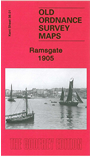
ere are the details of maps for Ramsgate:
This detailed and busy map covers most of central Ramsgate, with coverage stretching from Ellington Park eastward to the coast, and from the cemetery southward to Nelson Crescent.
Features include Town station, Harbour terminus, Granville Hotel, St George's church, malthouses, brewery, Royal Victoria Pavilion, Marina Pier, part of harbour, Albion Place Gardens, South Eastern College, Holy Trinity church, St Mary's church, Christ Church, St Catherine's Hospital, Chatham House School, Hereson area, Elms area, Coastguard Station, Eastcliff Lodge, tramways etc.
Follow this link for a complete list of our Kent Series maps.
You can order maps direct from our On-line Mapshop. For other information and prices, and other areas, go to The Index Page.
Maps in the Godfrey Edition are taken from the 25 inch to the mile map and reduced to about 15 inches to the mile. For a full list of maps for Kent, return to the South East page
The Godfrey Edition / godfreyedition@btinternet.com / 10 Jan 2011