
 Here are the details of maps for Brierfield:

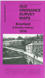
This detailed map covers the Brierfield and Reedley Hallows area north of Burnley. The eastern part of the map is busy with development along the Colne Road, with coverage stretching from Reedley Grove northward to Bank Street and the gasworks but the western half of the map is quite rural. Features include the railway with Brierfield station, Reedley Hall, tramway, Monkholme, Pendle Water, Leeds & Liverpool Canal, Meadow Bank Mills, Lob Lane Shed, Pendle View Shed, Brierfield Mills, St Luke's church, Market Place, town hall, Waterside, Holme End, Hawks House, Greenhead Lane. On the reverse we include a 1902 directory of Reedley Hallows and a 1918 directory of Brierfield.
The map links up with Lancashire Sheets 56.14 Burnley NW to the south.