 Here are the details of maps for Burnley North:

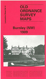
This detailed map covers the northern part of Burnley, with coverage stretching from Old Hall Street northward to Heald Wood, and from Bishop House Mill westward to the River Calder. Features include the railway with New Hall Bridge Halt, Old Hall Mill and several other mills, tramways and depot, Reedley Hallows Brick Works, Leeds & Liverpool Canal, Reedley Colliery, Lodge Mill, Crow Wood House, Royle. The western half of the map is quite rural. On the reverse we include a good selection of street directory entries, incl Abel Street, Barden Lane, Cleaver Street, Grey Street, Hurtley Street, New Hall Street, Waterbarn Street.
The map links up with Lancashire Sheets 56.10 Brierfield to the north, 64.02 Burnley to the south.