Old Ordnance Survey Maps of Wigan MBC

  • These detailed maps normally cover an area of about one and a half miles by one mile. Each map includes an introduction.
  • They are available through our On-line Mapshop

  • Here are the details of maps for Upholland:

  • Lancashire Sheet 93.05 Upholland 1907 - published 2009; intro by Alan Godfrey. ISBN.978-1-84784-304-3

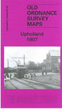
    This highly detailed map covers the village of Upholland, originally part of Wigan parish but today in West Lancashire. Coverage stretches from the village centre around St Thomas church, northward to St Joseph's RC College at Walthew Park, and from the Abbey Lakes Hotel westward to the disused Windmill Colliery. This is largely a rural map but features include the village centre (now a Conservation area), Hall Green, Upholland Corn Mill, Holland House, Holland Windmill, Newgate etc. On the reverse we include a 1918 directory of Upholland and Orrell.

    The map links up with sheet 93.06 Orrell Post to the east 93.09 Upholland South to the south.


  • Follow this link for a complete list of our Wigan or Bolton maps.
  • You can order maps direct from our On-line Mapshop. For other information and prices, and other areas, go to The Index Page.
  • Maps in the Godfrey Edition are taken from the 25 inch to the mile map and reduced to about 15 inches to the mile. For a full list of maps for the North West, return to the North West page.
    The Godfrey Edition / sales@alangodfreymaps.co.uk / 4 March 2018