Old Ordnance Survey Maps of Bolton MBC

  • These detailed maps normally cover an area of about one and a half miles by one mile. Each map includes an introduction.
  • They are available through our On-line Mapshop

  • Here are the details of maps for Hulton Park:

  • Lancashire Sheet 94.08 Hulton Park 1907 - published 2014; intro by Derrick Pratt. ISBN.978-1-84784-746-1

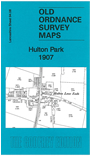
    This detailed map covers an area centred on the crssroads at Hulton Lane End.

    Features include Hulton Park (house and grounds), Hulton Collieries School Pit and Deep Arley Pit, Whitegate Brow, tramway, Back Gates Farm, Edge Fold Farm, Umberton's Farm, Cranberry Farm, Brook House Farm etc. A 1918 Westhoughton directory is included on the reverse.

    The map links up with sheet 94.04 Bolton Rumford to the north, 94.07 Westhoughton to the west, 95.05 Plodder Lane to the east, 94.12 Atherton NE to the south.


    Follow this link for a complete list of our Bolton maps.
  • You can order maps direct from our On-line Mapshop. For other information and prices, and other areas, go to The Index Page.
  • Maps in the Godfrey Edition are taken from the 25 inch to the mile map and reduced to about 15 inches to the mile. For a full list of maps for the North West, return to the North West page.
    The Godfrey Edition / sales@alangodfreymaps.co.uk / 23 November 2019