 Here are the details of maps for Earlestown (N):

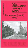
This detailed map covers the northern part of Earlestown and southern part of Haydock. Coverage stretches from Haydock Green southward to St John Street and Hotel Street, Earlestown.
Features include Earlestown Town Hall, St John the Baptist church, Crow Lane Farm, Haydock Colliery Railway, Newton Race Course (disused), Lyme Pits (disused), Wood Pit Colliery, Haydock Colliery Engine & Wagon Shops, Haydock Green, pumping station. On the reverse we include a 1918 directory of Earlestown.
The map links up sheet 101.11 Haydock North to the north, 101.14 Blackbrook to the west, 101.16 Newton-le-Willows to the east and 108.03 Earlestown South to the south.