 Here are the details of maps for Mossley (South):

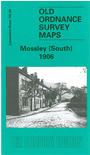
This detailed map covers a semi rural area on the east side of Tameside, with coverage stretching from Heyrod northward to Mossley Cemetery, and eastward into Cheshire as far as Carrbrook. No major towns are shown and only the southern tip of Mossley but there are several interesting features. These include a stretch of the main LNWR line incl Scout Tunnel, a stretch of the Stalybridge & Diggle Loop line with Staley & Millbrook station, the Huddersfield Canal, Spring-grove Mill, St James church, Luzley, Crows i'th' Wood, Scout Mill, Moorgate, Hydegreen, Carr Mill (disused). A directory of Mossley is included on the reverse.
The map links up with Lancashire Sheets 97.16 Mossley to the north and 105.03 Hurst to the west.