
 Here are the details of maps for Gateacre:

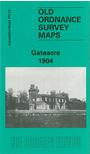
This detailed map covers much of the village of Gateacre, SE of Liverpool. Coverage stretches from Etopn Lodge and Gipsy Lane eastward to St Stephen's church, and from Childwall Hall southward to Beaconsfield Road. Other features include a stretch of Cheshire Lines Railway with Gateacre & Woolton station; many substantial villas around Gateacre incl The Grange, Ashleigh House, The Priory, Woolton Hill House Manhattan and others; Druids Cross, Belle Vale Hall, Belle Vale Farm, Gorsey Cop Farm, Childwall Park. On the reverse we include directory entries for Beaconsfield Road, Cuckoo Lane, Gateacre Brow, Grange Lane and Halewood Road.
This map links up with sheet 107.13 Childwall to the north, 113.04 Allerton to the west, 114.05 Woolton to the south.