Old Ordnance Survey Maps of Linlithgowshire

  • These detailed maps normally cover an area of about one and a half miles by one mile. Each map includes an introduction.
  • They are available through our On-line Mapshop

  • Here are the details of maps for Bo'ness:

  • Linlithgowshire Sheet 1.07 Bo'ness 1896 - published 1985; intro by Patrick Cadell. ISBN.978-0-85054-041-3

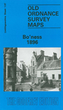
    This detailed map gives good coverage of Bo'ness - properly Borrowstounness - with coverage stretching from Deanfield Road and Furnace Rows eastward to Grangepans. Features include the harbour and dock; NBR railway with station, sidings etc; timber basin, North Street, South Street and town centre shown with individual buildings neatly shown, Cowdenhill, New Grange Foundry, Thirlstane, Forthbank Foundry, Wall of Antoninus, chemical works, Pit no.18, old quarries and pits, Distillery, Forth Chemical Manure Works, fever hospital, Corbiehall etc. Some contemporary directory extracts are included on the reverse.


  • Follow this link for a complete list of our Linlithgowshire maps.
  • You can order maps direct from our On-line Mapshop. For other information and prices, and other areas, go to The Index Page.
  • Maps in the Godfrey Edition are taken from the 25 inch to the mile map and reduced to about 15 inches to the mile. For a full list of maps for Scotland, return to the Scotland page.
    The Godfrey Edition / sales@alangodfreymaps.co.uk / 5 Nov 2016