
 Here are the details of maps for Maryhill & Ruchill:

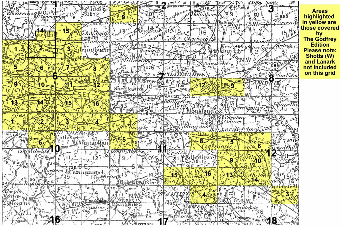
This detailed map covers an area of NW Glasgow that includes part of Maryhill (top left), Wyndford, Eastpark, Ruchill and Possil Park. Ruchill House is near the centre of an area that was being rapidly developed in 1894. Features on the map include Ruchill Park, the CR's Hamiltonhill Branch under construction, Firhill Iron Works, Western Saw Mills, Parkhouse Farm, Forth & Clyde Canal including Glasgow Branch, Phoenix Chemical Works, Tamshill, Gilshochill (top right corner), Maryhill Barracks, Lochburn Magdalene Institution, Maryhill Iron Works, several works alongside the canal, Kelburn Park. On the reverse we include a section of adjacent map 1.14, extending coverage northward to include Lambhill, part of Possil Loch, Kenmure Row, Lambhill House, Western Necropolis, St Kentigern's RC Cemetery, a further stretch of the Forth & Clyde Canal.
You might find this index map useful. The map links up with Sheets 6.01 Kelvinside to the west, 1.15 Bishopbriggs and 6.03 Springburn to the east, 6.06 Hillhead to the south.