
 Here are the details of the map for the Piccadilly area:

This highly detailed map at a 'Yard to the Mile' scale is dominated by Piccadilly, with Burlington House, much of it shown in some detail, near the centre of the map. Coverage stretches from Shepherd Street eastward to South Regent Street, and from Glasshouse Street southward to Pall Mall. Features include the University of London on Burlington Gardens, St James's Hall, Regent Circus South (today Piccadilly Circus), St James's Square, War Office, St James Theatre; several of the clubs incl Carlton, Reform, Brooks's etc; Devonshire House, Berkeley Square. On the reverse we include 1878 street directories for Albemarle Street, Burlington Arcade, King Street, Piccadilly, Sackville Street, St James Square and St James Street.
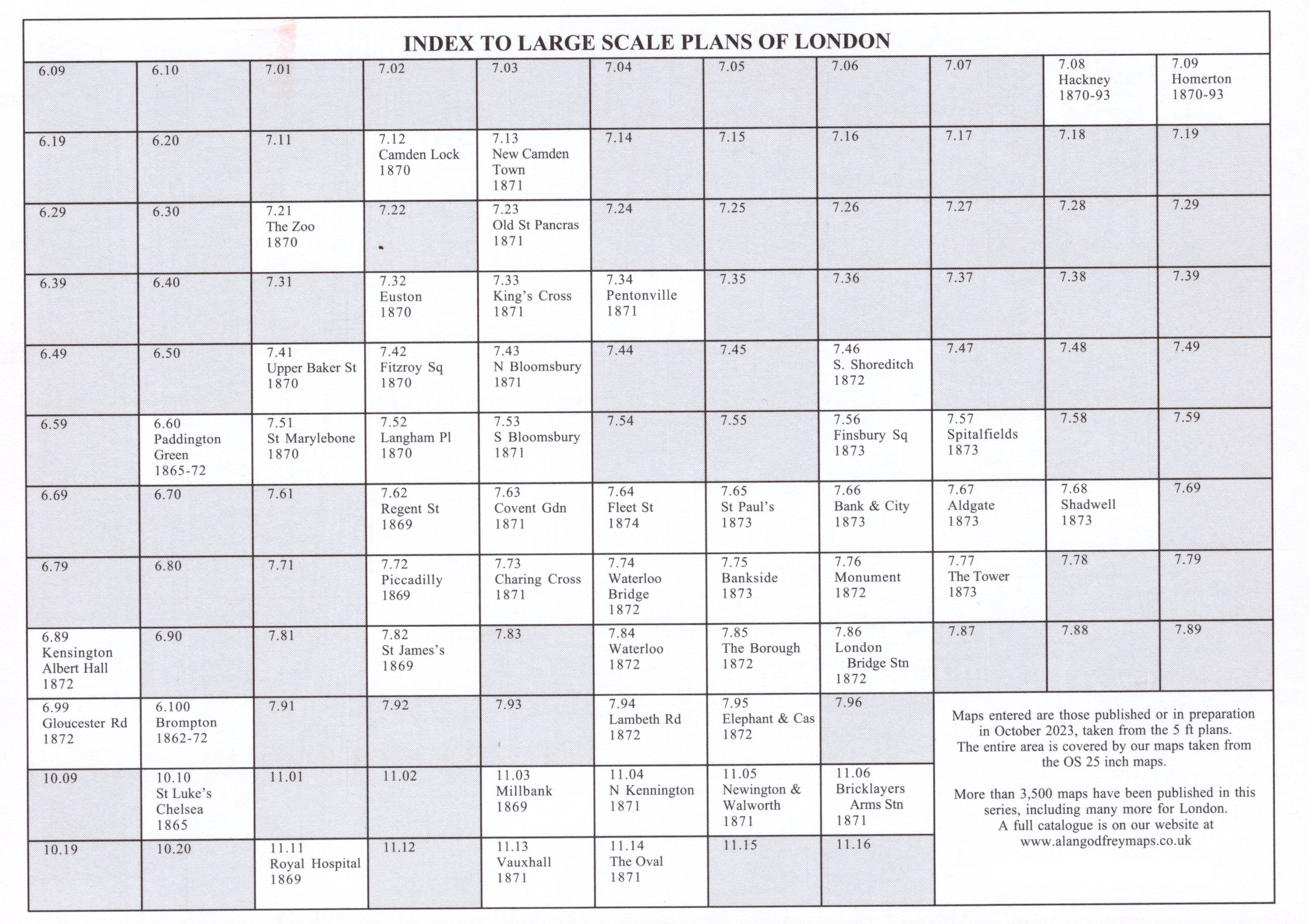
The map links up with sheets 7.62 Regent Street to the north, 7.73 Charing Cross to the east and 7.82 St James's to the south.