
 Here are the details of the map for the Bankside area:

This highly detailed map at a 'Yard to the Mile' scale covers a very interesting area of Southwark along the south bank of the Thames. Coverage stretches from Blackfriars Road eastward to Cannon Street railway bridge. Features on the map include Blackfriars station (south of the Thames), Christ Church, Phoenix Gas Works, Blackfriars Bridge, Anchor Brewery, Southwark Bridge, Vinegar Distillery, many wharves on both sides of river; a small area north of river is included showing Queenhithe Dock, Queen Street Place, St Paul's Pier. On the reverse we include street directories for Bankside, Blackfriars Road, Great Guildford Street, Holland Street, Park Street, Queen Street Place, Upper Thames Street.
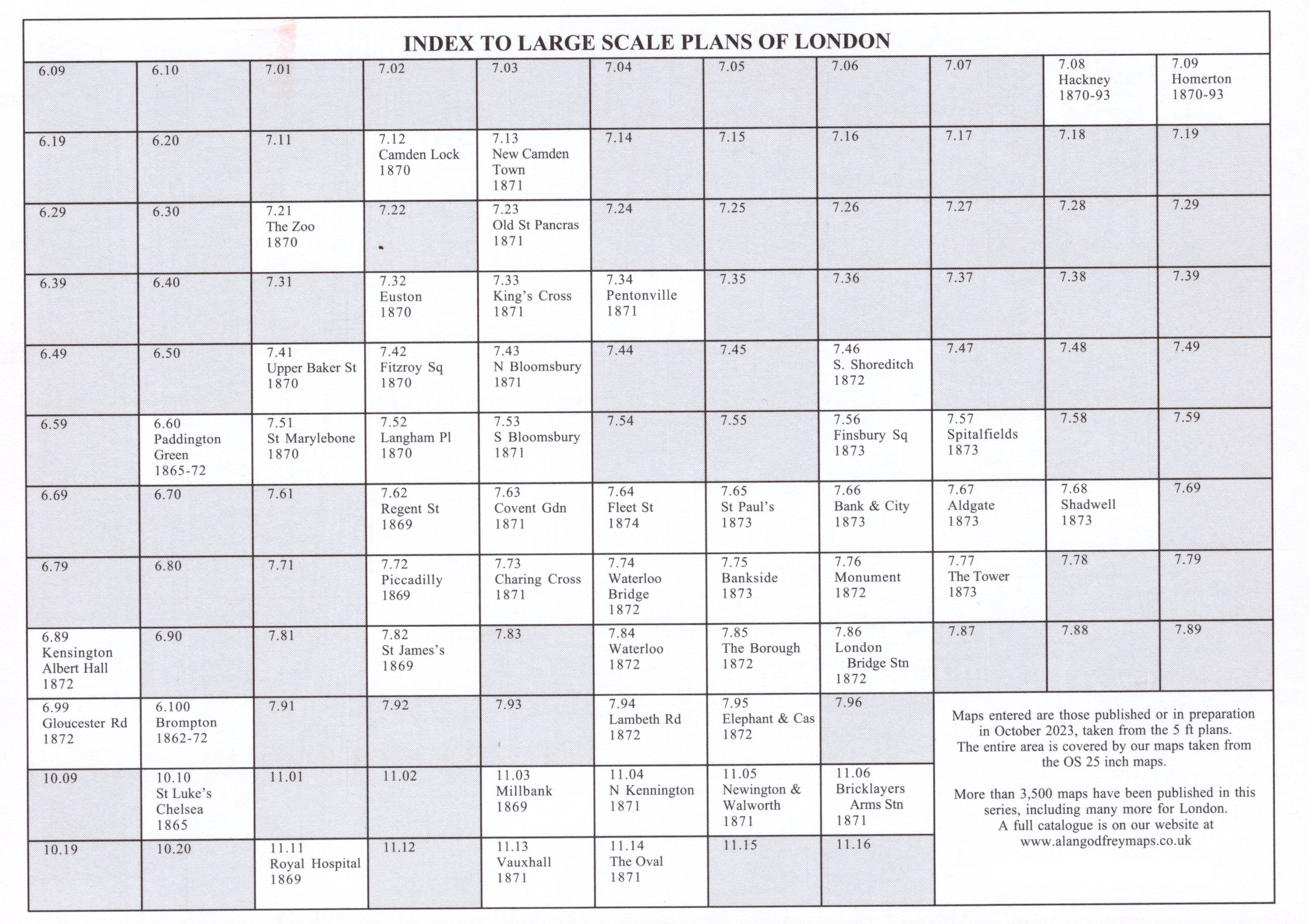
The map links up with sheets 7.65 St Paul's to the north, 7.74 Waterloo Bridge to the west, 7.76 Monument to the east, 7.85 The Borough to the south.