Old Ordnance Survey Maps of St James's


We have published more than 2,300 maps in our series of Old Ordnance Survey Map reprints, with a highly successful series for London. Most maps are taken from the OS 1:2500 (or 25 inch) maps and reduced to about 15 inches to the mile. Each covers an area of a mile and a half by a mile. These show the areas in considerable detail, including individual houses.

For a few areas of central London we have also reprinted some of the very early Five-foot plans. Originally published at a scale of 1:1056 or 5 feet to the mile, we have reduced them in scale to 1:1760 or a Yard to the Mile. The maps, though covering quite a small area, are quite wonderfully detailed, showing such features as lamp-posts, the layouts of back yards, and even the interior of certain buildings such as churches and theatres. For the urban historian they are perhaps the most fascinating maps ever published by the Ordnance Survey.

Our reprints are neatly folded and each includes a specially written introduction to the area. Maps can be purchased on our On-line Mapshop where further information about titles is given. Or visit The Index Page for a full list to the series and details of Prices.


Here are the details of maps for St James's:

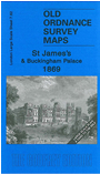
  • London Large Scale Series Sheet 7.82 St James's & Buckingham Palace 1869 - published 2009; Introduction by Chris Docherty

    This highly detailed map at a 'Yard to the Mile' scale is dominated by two great palaces, St James's Palace and Buckingham Palace, both shown in detail. Other features include Wellington Barracks, St James's Park, much of Green Park, Palace Gardens, Bridgewater House, Stafford House, Marlborough House, The Mall

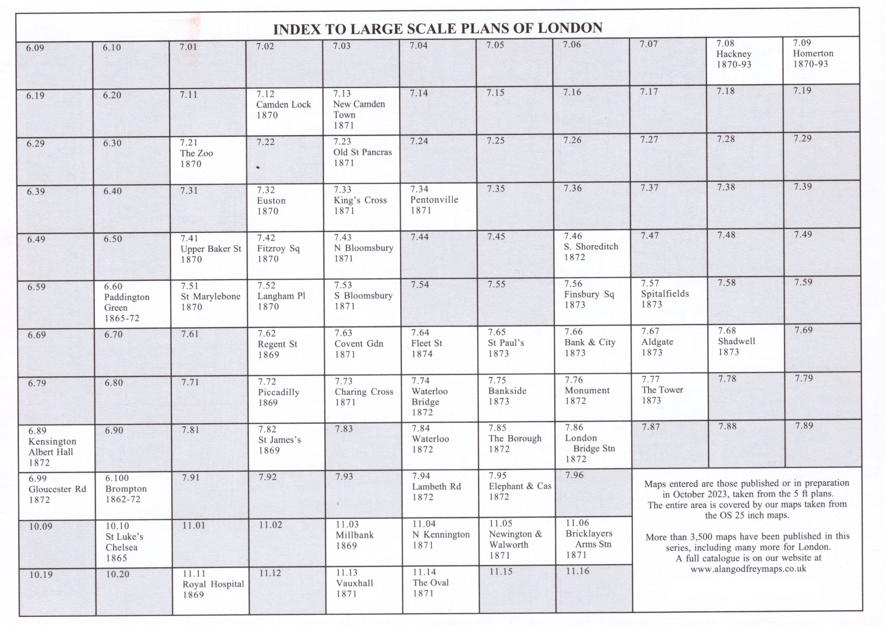
    The map links up with sheets 7.72 Piccadilly to the north.


    Follow this link for a complete list of our London Series maps.

    You can order maps direct from our On-line Mapshop. For other information and prices, and other areas, go to The Index Page.


    Most maps in the Godfrey Edition are taken from the 25 inch to the mile map and reduced to about 15 inches to the mile. For a full list of maps for London, return to the London page.

    The Godfrey Edition / godfreyedition@btinternet.com / 29 May 2009