We have published more than 2,300 maps in our series of Old Ordnance Survey Map reprints, some 500 of them in the London area. The maps are highly detailed. They are taken from the OS 1:2,500 (or 25 inch) maps and reduced to about 15 inches to the mile. They show streets with individual houses, tram tracks, railway tracks and even signals, factories, wharves and such details as fountains and water troughs. They will provide hours of fascination for historians and genealogists. The maps are neatly folded and each includes a specially written introduction to the area. Maps can be purchased on our On-line Mapshop where further information about titles is given. For other information and Prices, see Index Page.
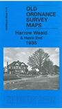
Here are the details of maps for Harrow Weald:
This map covers an area from Hatch End (in the SW corner of map) eastward to Clamp Hill and northward to Old Redding.
Features include the area called The City, Hatch End station, Royston Park, Clonard, Harrow Weald Park, Belgrano, All Saints church, Harrow Weald Lodge, Grim's Dyke house, Grimswood etc. On the reverse we include directories of Harrow Weald for 1890 and 1933.
The map links up with Middlesex sheets 5.16 Gt Stanmore to the east and 10.03 Wealdstone to the south.
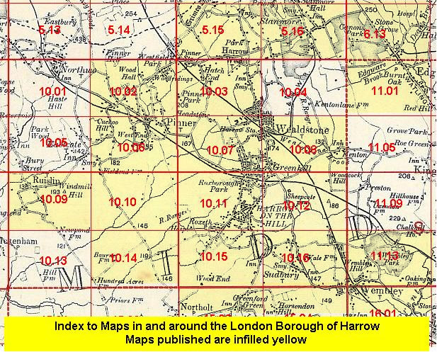
Follow this link for a complete list of our London & Middlesex maps .
You can order maps direct from our On-line Mapshop. For other information and Prices, see Index Page.
Maps in the Godfrey Edition are taken from the 25 inch to the mile map and reduced to about 15 inches to the mile. For a full list of maps for London, return to the London page.
The Godfrey Edition / godfreyedition@btinternet.com / 4 Nov 2009