
 Here are the details of maps for Hounslow Heath:

This detailed map covers the Hounslow Heath area, west of Hounslow, together with part of Feltham. Coverage stretches from Baber Bridge eastward to Cromwell Road, and from Connaught Avenue southward to Hounslow Cemetery.
Features include Army Vocational Training Centre, Bishopsgate Works, Hounslow Heath, Feltham marshalling yard, Feltham and Hounslow Junctions, River Crane, Sparrow Farm etc. On the reverse we include extracts from a 1933 commercial directory for Hounslow, entries A-E.
The map links up with Middlesex Sheets 20.06 Hounslow West to the north, 20.09 North Feltham to the west, and London Sheets 20.14 Hanworth Park to the south, and London sheet 109 Whitton to the east.
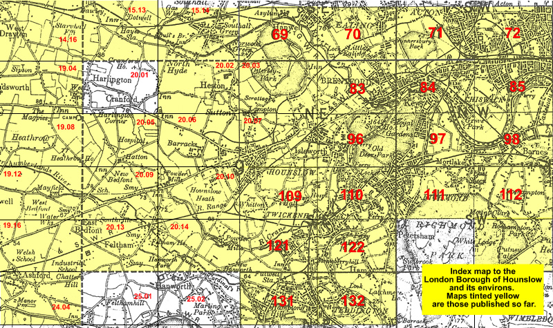 Follow this link for a list of our maps for the London Borough of Hounslow, or here for a complete list of our London maps .