 Here are the details of maps for Machynlleth:

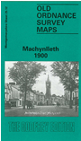
This detailed map covers an important mid Wales market town, where Owain Glyndwr is said to have held his Parliament in 1404. The site of the Parliament House is shown in Maengwyn Street. Other features include the Workhouse, Plas Machynlleth, Graig-fach, Llynlloedd, stations for Cambrian and Corris Railways, St Peter's church. The map extends about a mile east of the town, including Park Common, Dol-gau Woollen Factory, Afon Dulas, Felin-gerig Woollen Factory, old copper levels, Newlands. The introduction is in Welsh and English. A brief trade directory is also included.