 Here are the details of maps for Newtown :
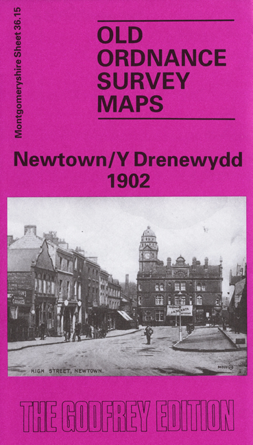
This detailed map is double-sided to give maximum coverage of this mid Wales town, and has an historical introduction, in both Welsh and English, by G G Evans. The main map covers the heart of the town, on the River Severn, and coverage extends across the river to the village of Llanllwchaiarn. Features include the Shropshire Union Canal with Basin, Cambrian Mill, Kymric Mill, Tannery, Newtown Saw Mills, Newtown Hall, St Mary's church, station, Royal Welsh Warehouse, Long Bridge, Pen-y-Glodfa, St Llwchaiarn's church Llanllwchaiarn (near NE corner), Broad Street and the crowded little passageways off it, Pont Bryn-fedw. On the reverse we include a portion of sheet 43.03, taking coverage further south to include more of the station area with Severn Valley Mill, sawmills etc.
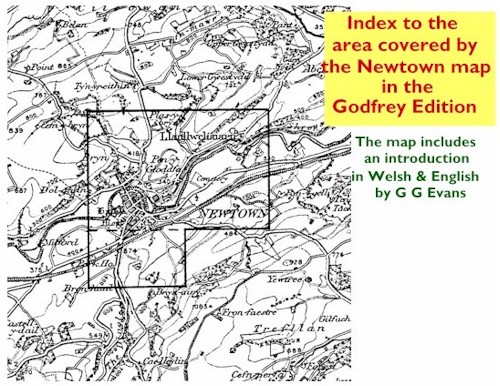
You might find this Index Map useful.