Old Ordnance Survey Maps of Northumberland
We have a range of detailed maps for Northumberland towns, and we also cover the whole county at the Inch to the Mile scale.
All maps are available from our On-line Mapshop.
Northumberland County Council was formed in 1889. There was a reorganisation in 1974, when parts of the county were transferred to the
new county of Tyne & Wear as Newcastle upon Tyne and North Tyneside Metropolitan Boroughs.
See This Page for a summary of the county's local government history.
 These are the maps we publish in Northumberland:
Note that the 20th century maps are on different sheetlines from those published in the 1890s and so have different numbers.
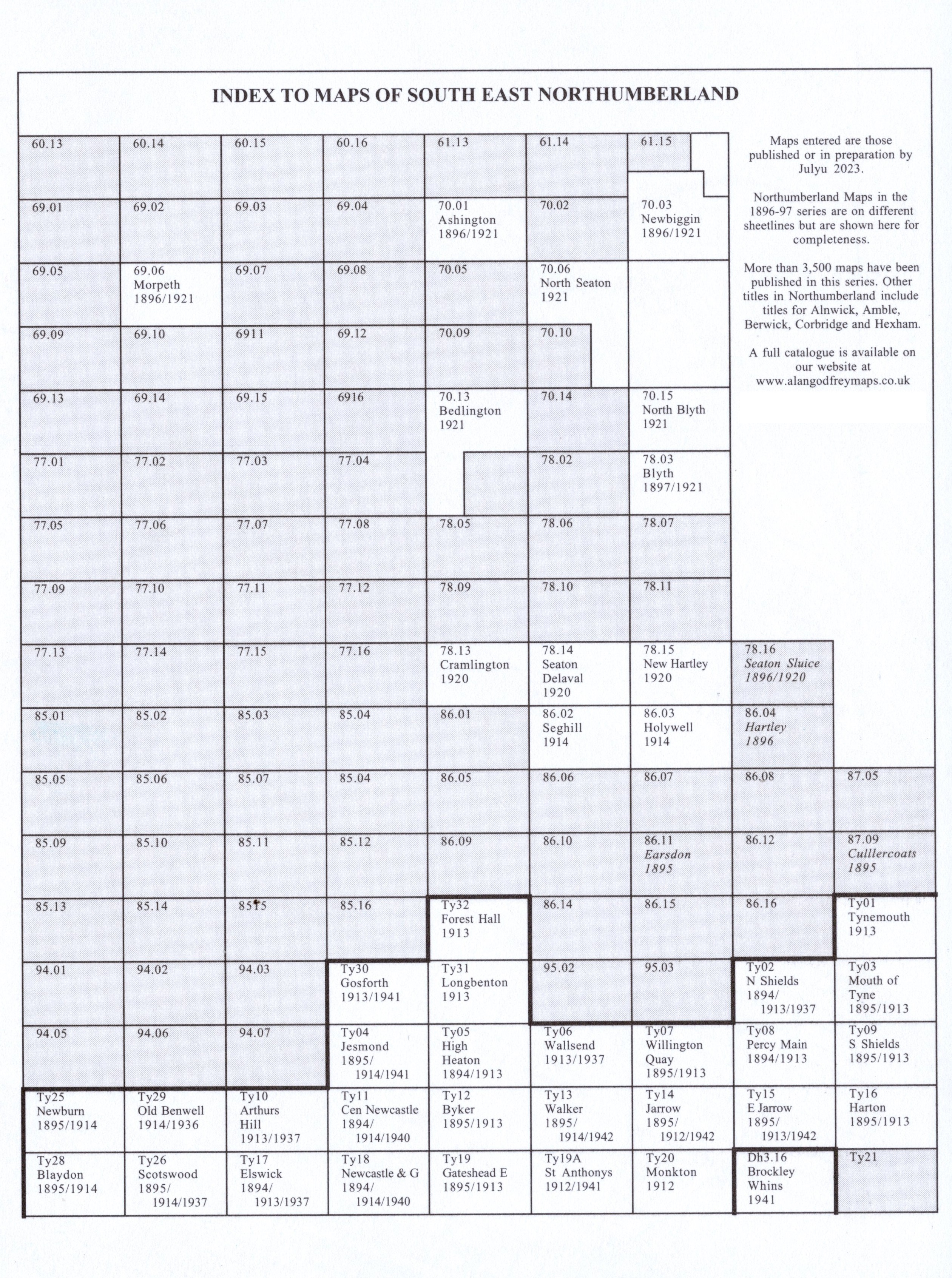
Here is an Index Map for SE Northumberland.
See also the pages for Newcastle upon Tyne and North Tyneside Metropolitan Boroughs.
We also cover the whole county in our Inch to the Mile series. These are the principal sheets for Northumberland:
For more details of this series go to the Inch to the Mile page.
 Most maps in the Godfrey Edition are taken from the 25 inch to the mile map and reduced to about 15 inches to the mile.
For a full list of English maps, return to the England page
You can order maps direct from our On-line Mapshop.
This list shows all our maps for the county. We try to keep a full range in print but inevitably some titles fall out of print from time to time. These are noted in our On-line Mapshop.
Most maps in the Godfrey Edition are taken from the 25 inch to the mile map and reduced to about 15 inches to the mile.
For a full list of English maps, return to the England page
You can order maps direct from our On-line Mapshop.
This list shows all our maps for the county. We try to keep a full range in print but inevitably some titles fall out of print from time to time. These are noted in our On-line Mapshop.
Alan Godfrey Maps, Prospect Business Park, Leadgate, Consett, DH8 7PW. Tel 01207 583388
The Godfrey Edition / sales@alangodfreymaps.co.uk / 27 November 2023
 These are the maps we publish in Northumberland: