Co Offaly Sheet 12.05 Edenderry 1911 - published 2011; intro by Ciarán J Reilly. ISBN.978-1-84784-488-0 
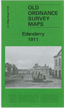
This very detailed map is double-sided for maximum coverage. The main map covers the centre and west of the town, including Main Street,
Workhouse, St Mary's RC Church, Grand Canal and harbour, Castropetre Church, Market Square, Blundell House, castle ruins.
On the reverse we include part of adjacent sheet 12.06 covering the east end of the town, including railway terminus.
Follow this link for a complete list of our Co Offaly Series maps.
You can order maps direct from our On-line Mapshop.
For other information and prices, and other areas, go to The Index Page.
Maps in the Godfrey Edition are taken from the 25 inch to the mile map and reduced to about 15 inches to the mile.
For a full list of maps for Ireland, return to the Ireland page.
The Godfrey Edition / sales@alangodfreymaps.co.uk / 16 January 2018

 Here are the details of maps for Edenderry: