
 Here is information about Sheet 95:
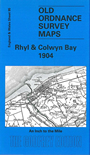
This map covers the north Wales coast from Little Ormes Head to Prestatyn. On the reverse is a map of the historic town of Rhuddlan. The map is split between Denbighshire and Flintshire, and includes a small detached area of Caernarvonshire.
It is not possible to list the many hamlets, farmsteads and other topographical features shown on these maps. However, you may find it useful if we list the towns and principal villages or church parishes that are included on this map. Links are given for those for which detailed large-scale maps are also available.
Index maps are available showing the areas covered by the Inch to the Mile maps. Go to This page
You can order maps direct from our On-line Mapshop. For a full list of Inch to the Mile maps go to the Inch to the Mile page, where you will also find details of prices. For information on the rest of the series, go to The Index Page.