
 Here is information about Sheet 110:
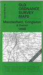
This One Inch to the Mile map covers much of SE Cheshire, together with a small part of Staffordshire. Coverage stretches from Middlewich eastward to Wincle, and from Macclesfield southward to the northern part of Crewe. Features include part of the Churnet Valley railway, the Macclesfield Canal, stretches of the North Staffordshire Railway, the Somerford Hall parkland (in the centre of the map), Rudheath, the Trent & Mersey Canal etc. On the reverse we include a detailed map of Elworth, Marsh Green and Boothlane Head, incl Sandbach station.
It is not possible to list the many hamlets, farmsteads and other topographical features shown on these maps. However, you may find it useful if we list the towns and principal villages or church parishes that are included on this map. Links are given for those for which detailed large-scale maps are also available.
Index maps are available showing the areas covered by the Inch to the Mile maps. Go to This page
You can order maps direct from our On-line Mapshop. For a full list of Inch to the Mile maps go to the Inch to the Mile page, where you will also find details of prices. For information on the rest of the series, go to The Index Page.