Old Ordnance Survey Inch to the Mile Maps

  • These maps normally cover an area of about 18 miles by 12 miles and are especially good at showing railways, roads and canals, and at giving a broad view of a wider area. Each includes an introduction and a more detailed map of a small town or village. They are available through our On-line Mapshop

  • Here is information about Sheet 127:

  • One Inch Sheet 127 Grantham & Sleaford 1898 - published 2009; intro by Barrie Trinder. ISBN.978-1-84784-230-5

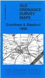
    This One Inch to the Mile map covers the area of Lincolnshire around and to the north of Grantham, stretching northward to Welbourn, eastard to Sleaford and Horbling. Features include the railways of the area, including the Lincoln & Honington Branch, Bourn & Sleaford Branch; Ermine Street, Haverholme Priory, Syston Park, Belton House etc. On the reverse we include a more detailed map of the village of Caythorpe, with a directory listing some of its inhabitants.


    It is not possible to list the many hamlets, farmsteads and other topographical features shown on these maps. However, you might find it useful if we here list the majority of the principal villages and church parishes that are included on this map. Links are given for those for which detailed large-scale maps are also available.

  • Lincolnshire: Allington, Ancaster, Anwick, Asgarby, Aswarby, Aunsby, Barkston, Barnby in the Willows, Barrowby, Beckingham, Belton, Bloxholm, Braceby, Brant Broughton, Brauncewell, Burton Pedwardine, Carlton Scroop, Caythorpe, Claypole, Cranwell, Culverthorpe, Dembleby, Dorrington, Dry Doddington, Evedon, Ewerby, Fenton, Foston, Fulbeck, Grantham, Great Gonerby, Haceby, Haverholme Priory, Haydor, Holdingham, Honington, Horbing, Hough on the Hill, Hougham, Kelby, Kirby la Thorpe, Leadenham, Leasingham, Londonthorpe, Long Bennington, Manthorpe, Marston, Normanton, North Rauceby, Osbournby, Quarrington, Roxholm, Ruskington, Scredington, Sedgebrook, Silk Willoughby, Sleaford, South Rauceby, Spanby, Stubton, Swarby, Syston, Threckingham, Walcot, Welbourn, Welby, Westborough, Wilsford.

    Index maps are available showing the areas covered by the Inch to the Mile maps. Go to This page


    You can order maps direct from our On-line Mapshop. For a full list of Inch to the Mile maps go to the Inch to the Mile page, where you will also find details of prices. For information on the rest of the series, go to The Index Page.


    Alan Godfrey Maps, Prospect Business Park, Leadgate, Consett, Co Durham, DH8 7PW / sales@alangodfreymaps.co.uk / 16 April 2011