
Old Ordnance Survey Inch to the Mile Maps
These maps normally cover an area of about 18 miles by 12 miles and are especially good at showing railways, roads and canals, and at giving
a broad view of a wider area. Each includes an introduction and a more detailed map of a small town or village.
They are available through our On-line Mapshop
 Here is information about Sheet 146:
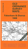
One Inch Sheet 146 Fakenham & District 1908 - published 2005; intro by Robert Malster. ISBN.978-1-84151-769-8
This One Inch to the Mile map covers a northern area of Norfolk, around and to the west and south of Fakenham. Coverage stretches from
Shernborne and Grimston eastward to Elmham Park, and from West Barsham southward to Castle Acre. As usual with Norfolk there are numerous small villages, and other features include Raynham Park (in the centre of the map),
Houghton Hall, Coxford Heath; also the Midland & Great Northern Joint Railway and a stretch of the GER Wymondham & Wells Branch. On the back we include an extract from Norfolk sheet 48.01 which shows the village of Litcham in detail,
complete with directory.
It is not possible to list the many hamlets, farmsteads and other topographical features shown on these maps. However, you might find it useful if we here list the majority of the principal villages
and church parishes that are included on this map. Links are given for those for which detailed large-scale maps are also available.
Norfolk: Alethorpe, Anmer, Ashwicken, Bagthorpe, Barmer, Beetley, Bircham Newton, Bircham Tofts, Brisley, Castle Acre, Colkirk, East Barsham, East Bilney, East Lexham, East Raynham, East Rudham, East Walton,
Fakenham, Flitcham cum Appleton, Gayton, Gayton Thorpe, Great Bircham, Great Massingham, Great Ryburgh, Gresenhall, Grimston, Harpley, Helhoughton, Hempton, Hillington, Horningtoft, Houghton, Kempstone, Kettlestone, Litcham,
Little Massingham, Little Ryburgh, Little Snoring, Longham, Mileham, North Elmham, Rougham, Roydon, Sculthorpe, Shereford, Shernborne, South Raynham, Stanfield, Stibbard, Syderstone, Tatterford, Tattersett, Tittleshall, Toftrees,
Weasenham All Saints, Weasenham St Peter, Wellingham, West Acre, West Barsham, West Bilney, West Lexham, West Raynham, West Rudham, Whissonsett.
Index maps are available showing the areas covered by the Inch to the Mile maps. Go to This page
You can order maps direct from our On-line Mapshop. For a full list of Inch to the Mile maps go to the Inch to the Mile page,
where you will also find details of prices. For information on the rest of the series, go to The Index Page.
Alan Godfrey Maps, Prospect Business Park, Leadgate, Consett, Co Durham, DH8 7PW / sales@alangodfreymaps.co.uk / 16 April 2011